I got a bit sidetracked while gathering a few maps together, found a lot of useful tutorials on yootoobe on map reading and navigating. Right where to start. Most people will be familiar with a tourist type map which you can use to find your way around a city or town you haven't visited before. I always head for a Tourist Information Office before I start wandering around getting lost. They are usually sign posted and situated in prominent positions. Once you have got your map, you need to pinpoint exactly where you are on it. Position yourself at a road junction, then find that spot on the map. Sometimes there will be an index to help you find it, or you may just have to go over the whole sheet untill you spot it. When you have your starting point you can plan where you are going to go next. Well that's straight forward enough on a big scale map where there are lots of landmarks.
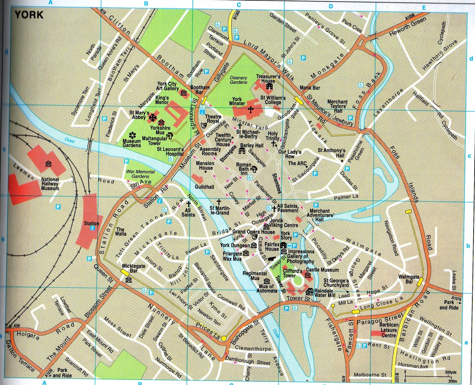
So, on this map of York, if I wanted to go from the Nunnery Lane car park to The Minster, I would walk up Micklegate, past a car park on the left, carry straight on, it then changes to Bridge Street. Then the road goes over the river at Ouse Bridge. On the other side I would turn left up Coney Street, past the Guildhall, turn right onto Stonegate, past Barley Hall, and The Minster is in front of me. An easy peasy map to read.
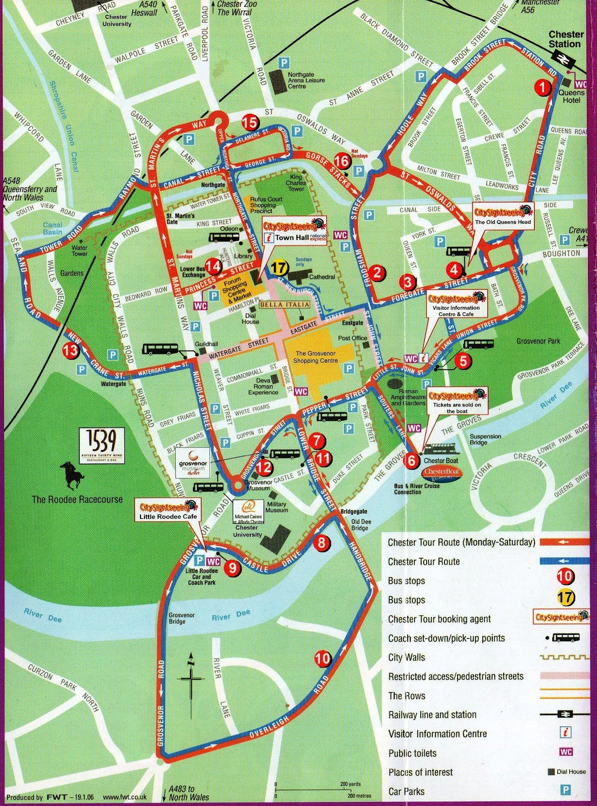
Here is another easy one. I picked this Chester map up last year as I was passing through. It was useful to visit a few places in the limited time I had available.
Now this map of Liverpool I printed off, because I needed to walk from Lime Street Station to James Street station, to catch another train. I wanted to go straight there, and not waste time getting lost. You will notice that there are a lot of minor streets which aren't named. If you needed to know the name of every single street you would have to look for another map which has the information you need, because if you zoomed in on this one it would only enlarge what was already there.

Maps used for walking have a legend. It is best to familiarise yourself with what all the dots and dashes, the symbols, the squiggly lines, and the different colours mean. On the Ordnance Survey maps there is such a lot of information to take in. You won't need to remember every single symbol, just look up the meaning of it if you come across one on the map. The most important ones tell you where you can and can't walk. The public rights of way, and the permisive footpaths which landowners allow the public to use. Another feature which is usefull are the contour lines, these tell you how steep the hills and mountains are, whether it is a gradual slope, or a very steep climb. Here are some examples of some legends.


It is best to familiarise yourself with the legend of the map you are using, before you go for a walk for the first time. This map of Worksop is an OS map Landranger Series, on a scale of 1:50. The long dotted red lines are bridleways, they should be wide enough for horses to walk along, but often they are not. The green patches are woods, or sometimes clumps of trees. These can be usefull to check your bearings, in fact any landmarks can confirm you are where you think you are. The railway lines are marked on here. When I walk I am constantly checking the map to make sure that what I see on the ground is exactly what is on the map. You will see some numbers in blue on this map, you don't need to bother with these as a beginner, they are for taking a grid reference. It would be usefull to learn about these later on as they are used to pinpoint an exact location, should you need to pass the information to someone else.

I've zoomed in a bit more, to make it easier to read. Now I can see the contour line around Black Hill Clump, it isn't very steep. Along the river you can see a red dotted line with red diamond shapes along it. This is a long distance footpath, the Cuckoo Way, running alongside the canal. The green dots are a long distance cycle path. On this map you can see the hospital, college, cemetary, railway station, golf course, school, river, tourist information office, camp site, a public house, sports centre, and church.

This map has lots of contour lines on it as there are some very steep climbs. It's in the Lake District. The closer together the lines, the steeper it is. The blue lines are the water trickling down fron the mountain top. There are not many trees around here as it's all mountains.The road and the river run through the valley. If you were to look up from the road the mountains would appear to be very steep. The black dotted lines are boundaries. If you stood on the top of Tarn Cragg you would get a lovely view of Stickle Tarn. There is a footpath going up from the road near the hotel to the Tarn. I went so far up that footpath with a group of walkers. They were going too fast for me and I wasn't enjoying it, so I came back down and did my own low level walk. I was pleased I did, because they had horrible weather up there, and I had a lovely sunny day.

This one I have scanned and copied from an OS 1:50. This is the scale of map I use for my long walks. It doesn't really have enough detail in it, and I have to squint over the top of my specs to read it, but if I was to go for the 1:25 scale, it would be like carrying a book around with me, far too heavy. There is enough information on these maps to walk from one end of the country to the other.

This is an OS Explorer map 1:25 scale. These are much easier to follow, with lots more information. It has all the field boundaries on it, whether they be hedges, fences, or stone walls.

There are a lot of guide books available for every kind of walk, whether it be a couple of miles, or a Pennine Way length walk. They usually have a hand drawn picture of the route, with written instructions. It is not a good idea to set off and rely soley on a book to show you the way. It is much better to take a map as well for a back up, or to clarify something you are not sure about. As you get used to maps, you will get a good idea of how far you can walk in a day. The book will say how long it should take someone to walk the route, but you may not walk at the same speed. What if you get half way round it and decide you want to cut it short and take a quick way back. The only option would be to retrace your steps and go back the same way as you came. Not much fun. Always best to take a proper map.

While I was writing this post I learnt how to do screen shots, Roberto told me about that little trick on a previous post, so thank you Roberto. There is so much to cover on the subject of maps, I shall continue with some more information tomorrow. Hopefully with some screen shots and videos.
Toodle pip.


I don't believe I'd be able to find all this info you have posted in my local library (or in such a concise way). Thanks Ilona for giving us your knowledge on walking.
ReplyDeletefrom Nancy in Northern California
I love maps and used to pore over them when I was a kid. I've a few of the very large scale ones for hill walks and the Isle of Man, as the iOM is small and you only need the one map. Very useful on the moors.
ReplyDeleteWhat is a screen shot please? Are you going into films??? Ha, I reckon you could do but think it is probably something to do with saving a page on a websige and in this case a map.
Tutorial in the following post, Campfire. Hope all is clear.
DeleteGood post,thanks Ilona.
ReplyDeleteRuth x
I was listening to Claire Balding's Ramblings show on Radio 4 the other day. It was really interesting, but I was surprised that the women she was walking with never bothered with printed maps - they used Google Maps! They admitted the occasional lack of signal was a problem, mind...
ReplyDeleteI think Google Maps can be useful, but I always try to take print maps with me if I can for just this reason.
I enjoyed this informative post Ilona.
ReplyDeleteEven though I was taught map reading at school, girl guides and also by my dad, I still learned some new stuff from this post...thank you.
My DH calls me Mrs Map because I love maps. Last night I was comparing a 1982 map with a2010 one. We hope to do a 5 day cycle tour at Easter.even though I could use electronic wizardry for navigation, I like a paper map.
ReplyDeleteBrenda in the Boro
I love maps. My DH calls me Mrs Map. Last night I was comparing a 1982 map with a 2010 map. We hope to cycle the Yorkshire Wolds way at Easter. Although I do have access to electronic maps, I prefer paper. Well done Ilona on your tutorial
ReplyDeleteBrenda in the Boro
You are welcome :)
ReplyDelete